The Anthropocene River
First published in Sanctuary Asia,
Vol. 37
No. 6,
June 2017
By Arati Kumar-Rao
Photographer, writer and gifted storyteller Arati Kumar-Rao has been documenting the wondrous Brahmaputra river, and those who depend upon it, for the past three years. Here, her lyrical prose is at odds with the devastating picture she paints, of a once-wild and invincible river beginning to cede to the assault of man.
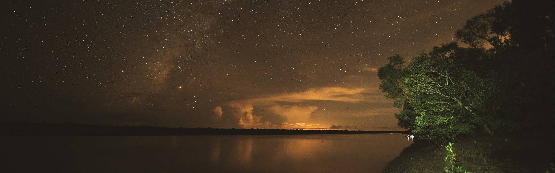
It was late February and silk cotton trees, bereft of leaves, were blooming a bright red in Assam. I stood on the banks of the Brahmaputra. There was no water in it, only sand. Dry season flows meant that the river had receded to only a few channels.
If you were to fly up 10 km. above this spot where I stood, here’s what you would see. Towards the north would rise mountains. Low and green at first and then higher, and higher, eventually capped white – the eastern Himalaya of Arunachal Pradesh, and beyond that Tibet – the wombs of these rivers. To the south you’d see the green hills of Nagaland. If you looked down, you’d see a million white-and-green islands of sand, braided with thin skeins of water, lying flatly along the spine of this land, Assam.
A large green expanse directly below would be Majuli, the largest populated river island in the world. If you did the same exercise in the monsoon, your jaw would drop at the scene below. The Brahmaputra spreads 18 km. across, in full flood. Standing where I was, I would not be able to see the other shore.
Right now, however, I could see no water. To reach the fisherman who was waiting to ferry my friend and me upriver, we’d have to walk at least a couple of hours to cross this sandy bed, wading through narrow and shallow channels en route, then climb up the side of a silt island (called a char), and down again to cross another shallow channel, then walk another hour over another char to reach the main stem of the river. Our fisherman was waiting there – eight kilometres away.
As we contemplated this journey (and eventually walked it hefting camera equipment and all), we saw locals bearing burdens, pulling loads, trudging the route patiently, uncomplainingly, tiredly, matter-of-factly.
This was how you’d traverse the Brahmaputra one half of the year. The other half would be by boat everywhere, for water would be everywhere. Welcome to one of the widest, wildest, siltiest, most temperamental yet beautiful rivers on earth.
The Freshwater Trail
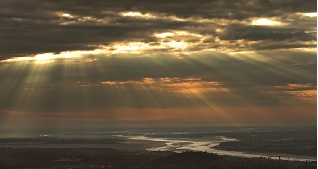
Push up from the plains of upper Assam into the mountains of Arunachal Pradesh along the Siang river, and you see JCBs gouging the mountainside making way for wide roads that will connect valleys within Arunachal Pradesh. Massive trees lie upended, roots turned skyward, as if begging for mercy. Too late. The rich naked earth flows in rivulets hundreds of metres down to the river.
The mighty Brahmaputra is known as Dihang or Siang in Arunachal Pradesh. Several dams planned over this river threaten to alter the fragile ecology of this landscape forever.Photo: Arati Kumar-Rao.
Further south, along the border, past orchid-swathed forests hemming the mighty Subansiri river, trucks wheeze and grumble along raw roads of scree, carrying towering piles of smooth round white rock. Some carry great uneven spheres of boulders. The grey dust of their passing obscures small-scale factories pulverising rocks for cement for dams, roads, buildings. Much needed development, the manner of implementation of which has devastating effects.
You move a boulder in the mountains and you change the course of a river in the plains.
These mountains are wombs of rivers. Rivers born of rain in those hills race down to nourish the floodplains – the food bowl – of Assam. When it rains, these rivers come alive.
If boulders or rocks are removed from river beds, they no longer hold down the sand underneath. The river moves in unimpeded and carts away the displaced sand. When a tree is uprooted, the mud from the banks comes loose. Erosion of the bank carves yet another path of least resistance for the river. The river gathers debris and speed and sans resistance, rushes to the plains with its new booty – heavy sand and mud.
Down in the plains, farmers in rain-fed paddy fields traditionally look to the mountains for a semaphore of the arrival of the monsoon-river. They know – from what their fathers taught them – that it takes six hours for the river to reach the plains, once it begins to rain in the hills. Enough time to get to higher ground, move their chattel and cattle, beat the floods.
Not any more.
Today, the farmers have no way of knowing what changes upstream mining and deforestation have caused. They know not what path the river will take. And they no longer know for sure how much time they have.
In 2014 it took only one hour for the rains in the mountains to flood the plains. Just one hour, not six. At one p.m. one monsoon day, the Simen river wandered a kilometre off its normal path, burst an old earthen embankment, and flooded some of the choicest paddy of the land.
But the flood itself was not the bad news, for floodplains are meant to flood with nourishing silt, and farmers are taught to look forward to it. The rivers today carry something far worse: heavy, inert sand set loose by boulder mining and road-making upstream. The river dumps its load on the paddy, smothering it several metres deep. The fields will lie unproductive for years.
All across upper Assam, dustbowls are replacing once lush food bowls. But this is not the only effect of mining and deforestation.
Habitat Destruction
Springtime in upper Assam holds the memory of winter with a sharp nip in the air. One April, a few years ago, Professor Hazarika, a fish scientist, and I had been criss-crossing the district, talking to fishermen about the changing river, the mining, the dams, and the deforestation. It was twilight by the time we were done and making our way back to the hotel.
In the purple-pink hour, which our nervous driver called “the elephant hour” we hurried through an area famous for “angry rogue elephants at twilight”. Crossing a bridge across one of many Himalayan streams, Hazarika suddenly motioned for the driver to halt. He jumped out of the car and ran down the bank. I followed.
Walking quickly across the soft sand, past massive footprints of elephants, we reached a smudge of water. Hazarika waded in, crouched at one point, and carefully moved a small river rock. Two baleful eyes stared back at us – a snakehead fish, about as long as my index finger, heavy with eggs. “This is an endangered species,” he explained.
Small indigenous fish (SIF) like the snakehead find refuge, eat, and breed around river rocks, submerged roots, and fallen logs, in the nooks and crannies of soft-flowing streams, and in coves. These are prime habitat for the fish. “If you take those ‘obstacles’ away, you destroy vital fish breeding habitat.”
Mining rock from rivers, deforesting and smoothening of river banks, destroys crucial foraging and breeding habitat for endangered riverine species. Hazarika has discovered another fish, Danionella priapus, among the smallest in the world, in these streams. It was in danger of becoming extinct even before science had properly described it.

Sand set loose by boulder mining and road-making is dumped by the river on paddy fields downstream rendering them unproductive for years. Such destructive actions are being replicated all across upper Assam. Photo: Arati Kumar-Rao.
In the eastern Himalaya, fish biodiversity and fish populations have plummeted but the extent cannot be accurately determined due to “lack of sufficient data” on a lot of species. Declining freshwater species is not particular to this region. “Freshwater animals are disappearing at a rate four to six times as fast as animals on land or at sea,” reports the National Geographic.
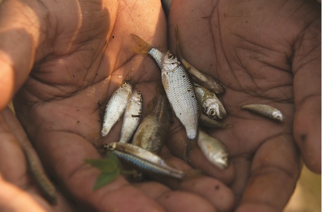
Altering the course of a river destroys crucial foraging and breeding habitat of small indigenous fish (SIF).
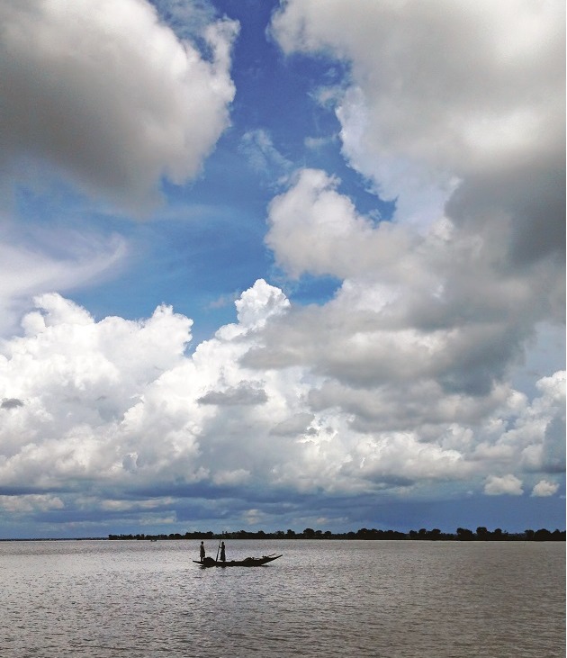
In the Indian subcontinent, the threats to freshwater species come thick and fast, even in the form of hulking, dirty ships.
Waterways to Hell
On December 9, 2014 on the river Sela in Bangladesh’s Sundarbans, a ship rocked gently, moored in a winter’s thick pre-dawn fog. An oncoming cargo ship failed to see it and rammed into it. The moored ship split in two, spilling its bowels into the forest river. It was carrying 3,58,000 liters of heavy fuel oil. For the next few weeks, the thick viscous goo sloshed up and down, painting the shoreline and mudflats of the mangroves black.
The Sundarbans straddle the border between India and Bangladesh and is home to six kinds of dolphins –including the highly endangered Gangetic dolphin. The royal Bengal tiger, the Masked Finfoot, river sharks, a slew of crustaceans, and more have turned this margin of brine and freshwater into one of the most biodiverse environments in the world, which serves as the first line of defense against rising sea levels.
Cargo ships and oil-tankers have no business plying through these forests. But they’re there. Coal, pesticides, fertilisers, salt, oil, fly-ash, grain, sand, all chug through the forest waters. Bangladesh’s plans to build two coal-fired thermal power plants at the head of the Sundarbans ecosystem means the hazardous cargo chugging through forest rivers is set to double. As one Bangladeshi scientist put it, these are not ships, they are “mobile bombs.” Every now and then, one of them explodes. The most recent mishap spilled 1,000 tonnes of coal into the river.
Clouds loom over the water channels and mangrove forests of the Bangladeshi Sundarbans, close to where the Rampal Power Station, a 1320 megawatt coal-fired power plant, has been proposed to be built. Photo: Arati Kumar-Rao.
The threat from hazardous shipping traffic is not in Bangladesh alone. India has ambitious plans for waterways, notifying Ganga as National Waterway 1, and Brahmaputra as National Waterway 2. Unfortunately, this covers 90 per cent of the range of the side-swimming, blind, national aquatic animal of India, the Gangetic dolphin.
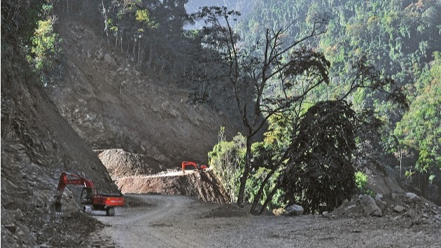
JCBs gouge the mountainside along the Siang river to make way for wide roads that planners say will connect valleys within Arunachal Pradesh. Photo: Arati Kumar-Rao.
Researchers studying the dolphin in the Ganga have begun to see changes in the behaviour and population of the cetaceans in areas dredged for waterways. The virtually-blind dolphins rely on echolocation to locate prey, and breed. Nachiket Kelkar, of ATREE, says that high levels of interference from ships and dredgers show up as stress in the cetaceans – their dive times increase, they move away. Dredging for waterways also destroys prime fish breeding habitat in the benthic layers at the bottom of the riverbeds.
Indeed, last summer, at a time when dolphin activity in the Vikramshila Gangetic Dolphin Sanctuary should have been at its peak, dredging was rife in the sanctuary. Where we should have sighted over a hundred dolphins on a routine trip down the length of the sanctuary,
we saw less than a handful. There are about 2,000 of these magnificent creatures left in the world, yet we seem to heed no warnings from research nor lessons from China, which saw its much-loved river dolphin, baiji, go extinct.
.jpg)
On December 9, 2016, a wrecked tanker ship released approximately 3,58,000 litres of heavy fuel oil into the Sela river in Bangladesh’s Sundarbans. Over the following days, the oil spread to a second river and a network of canals, with environmentalists labelling it an ecological catastrophe of unprecedented proportions.Photo: Arati Kumar-Rao.
Politics of Thirst
It’s hard to overplay the knock-on effects of what we do to rivers and riparian habitats. Upstream changes have basin-wide implications that can unfold over temporal scales. It is what Rob Nixon terms a “slow violence”. Such hostility, inflicted on communities and species by environmental degradation and climate change, is neither spectacular nor explosive, and it remains invisible and unreported (or underreported) for years, its true implication manifesting over several generations.
The Farakka barrage is a case in point. What was built with the intention of desilting the port of Calcutta in the 70s, and spectacularly failed at it, has instead led – decades later – to the near-complete collapse of fish assemblages in the Ganga, exacerbated bank-line erosion, accentuated floods upstream in Bihar, resulted in rampant human migration from the region, and degenerated into tired political leverage for water-politics with Bangladesh.
Driven by a frenzied hunger for growth, India today has stepped up re-engineering her landscape in the name of development: damming, diverting, and planning to link rivers, drowning forests, mining deserts, building over marshes, and auctioning off grasslands.
The fallouts of these massive, potentially disastrous landscape-level changes may prove a heavy burden for the next generation to bear.
Author: Arati Kumar-Rao